Los Alamos Sferic Array Investigation of Lightning VLF/VHF
Phenomenology
M J Heavner,
D A Smith,
A Jacobson, A Waldrum, J Harlin, and K Eack
LAUR-00-4198
Los Alamos Sferic Array
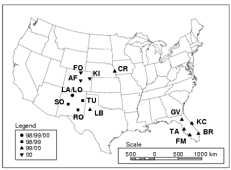
The locations of the LASA stations
are shown below.

Each station is comprised of a flat
plate electric field antenna, a GPS for time-stamp accuracy greater
than 2 us, and a computer for collecting data and providing
remote operation capabilities. The 1998 and 1999 array
operations are described by Smith et al, 2000.
Motivation
The Los Alamos Sferic Array was originally
deployed for ground truthing of the FORTE satellite lightning
observations. Studies of coincident
National Lightning Detection Network (NLDN) and FORTE observations
found that FORTE and NLDN have reasonable coincident observation of
some storms while other storms are apparently missed. One example
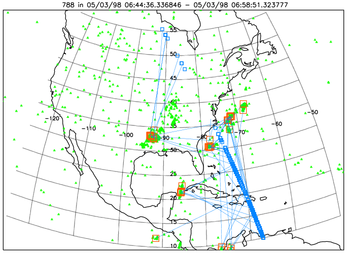
FORTE overpass (~14 min.) is shown at left (see Jacobson et
al., A52C-20, this session).

The subsatellite point of FORTE RF triggers are indicated by blue
squares. All National Lightning Detection Network
events recorded during the satellite overpass are
shown as green triangles. A close temporally
associated between a FORTE trigger and an NLDN event
is indicated with a blue line connecting the two as
well as a red square around the NLDN event. Not that
some storms are well identified by FORTE, while other
storms are apparently completely missed.
Links to:


